跳转到内容
网站首页
团队成员
团队概况
骨干成员
张老师
杨婧雯
研究生
留学生
基层人才
博士
2025级
2024级
本科生
2023级
2022级
2021级
2020级
2019级
2018级
2017级
2014级
2013级
2012级
研究成果
发表论文
获奖情况
发明专利
软件著作
教学成果
科研项目
一流课程
遥感与地理信息系统
中文 (中国)
English
haibao2
2026年毕业生集体大合照
fd2b5f2f7ce156e80544fe03fdcb3bd0
实习照片2
屏幕截图 2024-06-05 212814
P1030545
P1030598
1
P1030598
Academic Dynamics
Academic Achievements
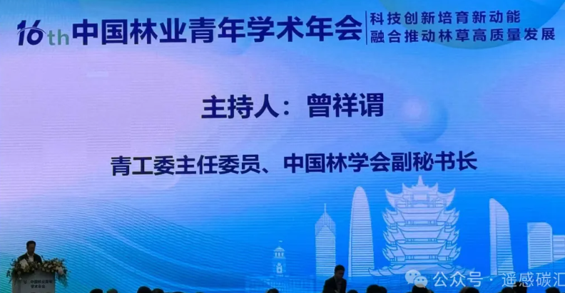
The research group participated in the 16th China Forestry Youth Academic Annual Conference
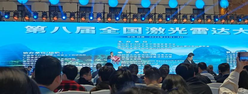
The research group participated in the 8th National LiDAR Conference
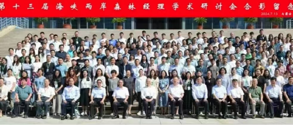
The team of Professor Zhang Jialong of the research group participated in the 13th Cross-Strait Forest Manager Academic Seminar
Warmly welcome Dr. Xu Dongfan from Fudan University to return to the university for academic exchanges
Learn more
Chen, Chaoqing, Yunrun He, Jialong Zhang*, Dongfan Xu, Dongyang Han, Yi Liao, Libin Luo, Chenkai Teng, and Tangyan Yin. 2023. "Estimation of Above-Ground Biomass for Pinus densata Using Multi-Source Time Series in Shangri-La Considering Seasonal Effects" Forests 14, no. 9: 1747.
Liao, Yi, Jialong Zhang*, Rui Bao, Dongfan Xu, and Dongyang Han. 2022. "Modelling the Dynamics of Carbon Storages for Pinus densata Using Landsat Images in Shangri-La Considering Topographic Factors" Remote Sensing 14, no. 24: 6244.
Xu, Dongfan, Jialong Zhang*, Rui Bao, Yi Liao, Dongyang Han, Qianwei Liu, and Tao Cheng. 2022. "Temporal and Spatial Variation of Aboveground Biomass of Pinus densata and Its Drivers in Shangri-La, CHINA" International Journal of Environmental Research and Public Health 19(1):1-17.
Bao Rui, Zhang Jialong*, Lu Chi, et al. Estimating above-ground biomass of Pinus densata Mast. using best slope temporal segmentation and Landsat time series[J]. Journal of Applied Remote Sensing. 2021,15,(2):024507.
Zhang Jialong*, Lu Chi, Xu Hui, et al. Estimating aboveground biomass of Pinus densata-dominated forests using Landsat time series and permanent sample plot data[J]. Journal of Forestry Research. 2019,30,(5):1689-1706.
Cheng Tao, Zhang Jialong*, Zheng Xinyan, et al. Land cover's refined classification based on multi source of remote sensing information fusion: a case study of national geographic conditions census in China[C]//10th International Symposium on Multispectral Image Processing and Pattern Recognition (MIPPR) - Remote Sensing Image Processing, Geographic Information Systems, and Other Applications. 2018.
Learn more